Photo: Alexey Komarov / Wikimedia Commons, CC BY-SA 4.0
Isle of Man walks — the best ones, from an hour on a headland to 100 miles round the coast
Photo: Alexey Komarov / Wikimedia Commons, CC BY-SA 4.0
Last checked
The best walks on the Isle of Man, from Bradda Head and the Chasms to Snaefell, the Millennium Way and the 100-mile coastal path, with distances and how to get back.
On the map
- Bradda Head (from Port Erin) — Start at Port Erin station; Milner's Tower on the headland
- Port St Mary station — Start of the Chasms walk to Port Erin
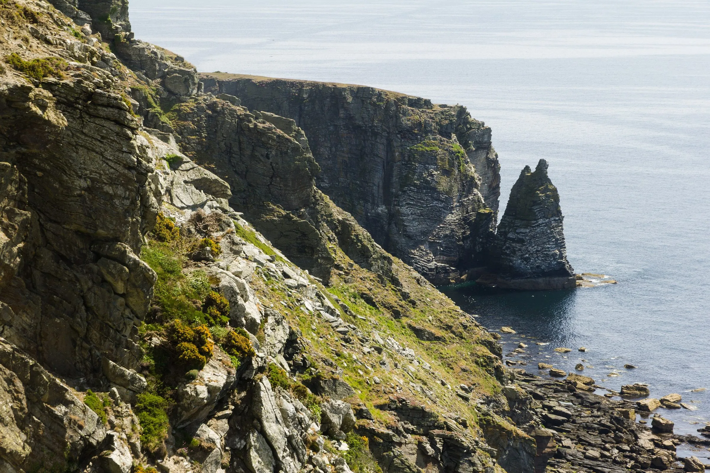
- The Chasms — Deep clefts in the cliff. Stay on the path
- Peel Hill and Corrin's Tower — Start at Peel harbour, climb to the tower
- Bungalow (for Snaefell) — Snaefell tram stop and path to the summit
- Castletown station (for Langness) — Start of the Derbyhaven and Langness loop
- Douglas Head — Start of Marine Drive to Port Soderick
- Maughold church (for Maughold Head) — Start here; the headland and lighthouse are just east
- Laxey station — Start of the Laxey to Ramsey over Snaefell walk
- Heritage Trail (Quarterbridge) — Douglas end of the old railway to Peel
- Sky Hill (Millennium Way) — Near the Ramsey end of the Millennium Way
The Isle of Man is 33 miles long and has more good walking per square mile than it gets credit for: sea cliffs in the south, a proper mountain in the middle, wooded glens and a coastal path the whole way round. This page lists the best walks from an hour to a week, with the start, the distance, how hard they are and how to get back without walking the same way twice. It’s for visitors who walk as part of a holiday, not just serious hikers. The serious hikers should skip to the long-distance paths.
The best walks at a glance
Distances are from Visit Isle of Man’s self-guided walks (opens in a new tab) where it publishes one (checked September 2026). Where it doesn’t, we say so. Times are our rough guide for an unhurried pace with stops.
| Walk | Start | Distance and time | Grade and best for |
|---|---|---|---|
| Bradda Head and Milner’s Tower | Port Erin station | 4.7 miles to Fleshwick; tower alone is shorter. 1–3 hr | Moderate. Sunsets, first day |
| Port St Mary to Port Erin via the Chasms | Port St Mary station | About 5 miles, 2.5–3 hr | Moderate. The best cliffs on the island |
| Peel Hill and Corrin’s Tower | Peel harbour | Short: 1–2 hr there and back | Moderate climb. Views of the castle |
| Snaefell from the Bungalow | Bungalow tram stop | About a mile each way, 45 min up | Rough path. The view, clear days only |
| Castletown, Derbyhaven and Langness | Castletown station | 7.2 miles, 3–4 hr | Easy. Birds, seals, flat ground |
| Douglas Head to Port Soderick | Douglas Head | About 3.5 miles one way, 1.5–2 hr | Easy. No car, starting from Douglas |
| Maughold Head | Maughold church | Short loop, 1–2 hr | Moderate. Quiet, the east’s best headland |
| Laxey to Ramsey over Snaefell | Laxey station | 12.5 miles, 6–7 hr | Strenuous. A proper day on the hills |
| The Heritage Trail | Quarterbridge, Douglas | About 10 miles to Peel, 4 hr | Easy, flat. Dogs, families, wet days |
| Millennium Way | Sky Hill, Ramsey | 28 miles to Castletown, 1–3 days | Hard. Upland walkers |
| Raad ny Foillan | Anywhere on the coast | About 100 miles, 5–12 days | Varies. The full coast |
Short walks: an hour or two
Bradda Head and Milner’s Tower, Port Erin
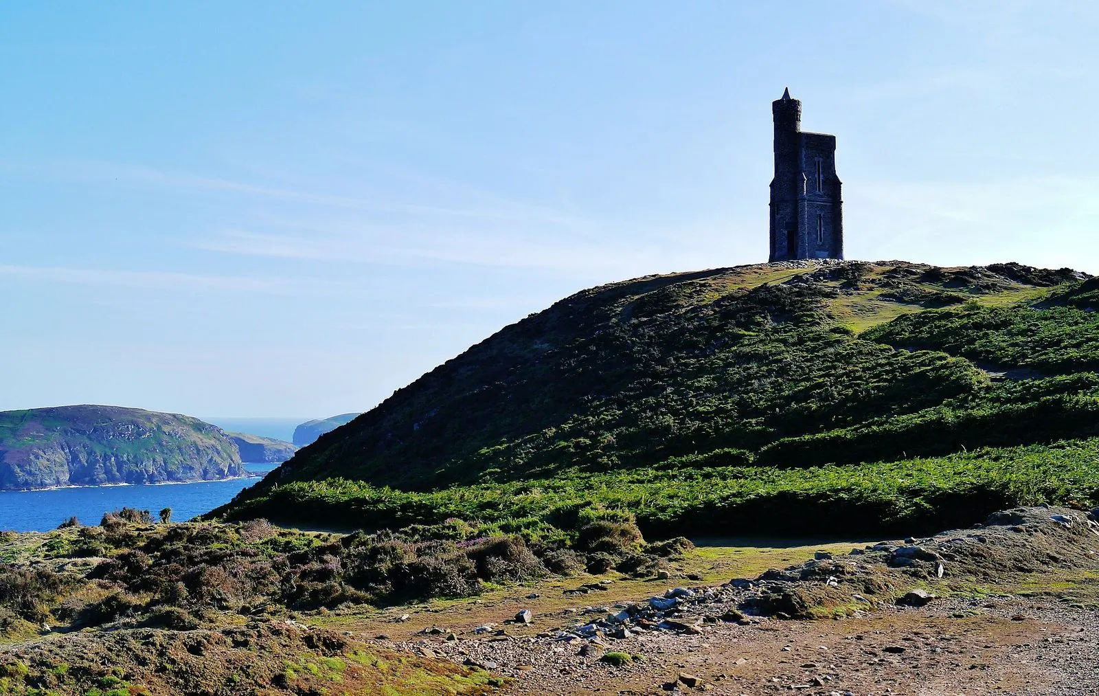
From the north end of Port Erin beach, a path climbs through Bradda Glen and up onto the headland to Milner’s Tower. It was built in 1871 in memory of William Milner, a safe-maker, and it’s shaped like a key and lock when seen from above, which you can’t see from the ground. The headland is 382ft high, and from the top you look back over the bay, down to the Calf of Man and, on a clear evening, across the sea to Ireland.
Carry on north along the Raad ny Foillan and you reach Fleshwick Bay. Visit Isle of Man’s railway ramble (opens in a new tab) does that route at 4.7 miles from Port Erin station.
Verdict: the best first walk on the island. Go an hour before sunset.
Peel Hill and Corrin’s Tower
Cross the harbour from Peel, climb the grassy hill behind the castle, and follow the ridge south to Corrin’s Tower, a square stone folly with a scatter of small stone pyramids around it. The climb is short and steep, and the view back over Peel Castle and the town is the best in the west. There’s no official distance for this one: it’s a short out-and-back, and you can extend it south along the coast to Glen Maye.
Verdict: do it on the same day as Peel Castle.
Snaefell from the Bungalow
Snaefell is the island’s only mountain over 2,000ft, at 2,037ft. The local line is that on a clear day you can see six kingdoms from the top: Mann, England, Scotland, Ireland, Wales and heaven. The quickest route is the rough path from the Bungalow on the Mountain Road. It takes about 45 minutes up in dry weather. The Snaefell Mountain Railway also stops at the Bungalow, so you can ride one way and walk the other while it’s running (it runs in the heritage railway season, which in 2026 ends on 1 November).
Verdict: only on a clear day. In cloud you’ll see a trig point and your own boots.
Maughold Head
The most easterly point of the island, about 3 miles from Ramsey. Start at Maughold’s old parish church, which keeps a collection of carved stone crosses, and walk out over the brooghs towards the headland. The lighthouse, built in 1914, sits below the cliffs. Cumbria is about 31 miles away, so on a clear day England is right there.
Verdict: the quietest good headland on the island. Pair it with Ramsey.
Half-day walks
Port St Mary to Port Erin via the Chasms
The best walk on the island. From Port St Mary, the coast path climbs south past the Chasms, deep clefts where the cliff has split away from the land, then over Spanish Head to the Sound. There, there’s a café (opens in a new tab) and a view of the Calf of Man and its seals. From the Sound you walk up to Cregneash and down into Port Erin. Visit Isle of Man’s version of the route (opens in a new tab) is 4.95 miles, starting from Port St Mary station. The steam railway links the two ends, so you don’t have to walk back.
A section of this path, between the Sound café and the Chasms, was closed briefly on 27 August 2026 when old military ordnance was found. It was cleared and reopened the same morning, Manx Radio reported (opens in a new tab). It’s a reminder to follow any tape or signs you find up there.
Verdict: if you do one walk on the island, do this one.
Castletown, Derbyhaven and Langness
A flat walk from Castletown station round the bay to Derbyhaven, then out onto the Langness peninsula. You’ll pass the Herring Tower, a daymark from 1811, and reach Langness lighthouse, built in 1880 after too many shipwrecks. You can also cross the causeway to St Michael’s Isle and its ruined chapel and fort. It’s 7.2 miles on Visit Isle of Man’s route (opens in a new tab), graded leisurely. Langness is good for wading birds and seals (more on Manx wildlife).
Verdict: the best walk for anyone who doesn’t like hills. Finish with Castle Rushen.
Douglas Head to Port Soderick
The old Marine Drive runs south from Douglas Head along the cliffs. A tramway ran along it from 1896 to 1939, and landslips closed the road to traffic long ago. Now it carries the coastal path for about 3.5 miles to Port Soderick. From Port Soderick you can walk up the glen to the steam railway halt and ride back to Douglas, though the halt is a request stop, so check the timetable (opens in a new tab) before you rely on it.
Verdict: the best walk you can start on foot from a Douglas hotel.
The glens
The island’s 18 national glens are free, open all year and good in drizzle. Glen Maye and Dhoon have the waterfalls, and Silverdale is the easy one with small children. Most visits are an hour or two. The national glens guide has all 18.
Full-day walks
Laxey to Ramsey over Snaefell
Up from Laxey through Agneash, over Snaefell and down via Sky Hill to Ramsey. It covers 12.5 miles and is graded strenuous on Visit Isle of Man (opens in a new tab). The Manx Electric Railway links Laxey and Ramsey, so you can park at one end and take the tram back, or come out from Douglas by tram.
Verdict: the best hill day on the island, in good weather. Leave it for another day if the cloud is down on the summit.
The Heritage Trail, Douglas to Peel
The old Douglas to Peel railway line, now a flat, hard-surfaced path. It starts at the Quarterbridge roundabout on the edge of Douglas and runs about 10 miles to Peel via St Johns. It’s shared with cyclists and horses, and it’s sheltered by trees for much of the way. Buses run between Peel and Douglas, so you can walk it one way. The cycling guide has more.
Verdict: good in weather that rules out the hills, and easy with dogs.
Long-distance paths
Raad ny Foillan: the coastal path
The “Way of the Gull” goes all the way round the island. It’s about 100 miles, waymarked with a gull on a blue sign, and opened in 1986. Most people do it in stages over a week or two, or cherry-pick the best days. Stages, distances, closures and logistics are in our Raad ny Foillan guide.
The Millennium Way
A 28-mile route from Sky Hill above Ramsey to Castle Rushen in Castletown. It opened in 1979 to mark 1,000 years of Tynwald and roughly follows the royal road the medieval kings of Mann used between the two towns. It crosses the uplands on the flank of Snaefell and then drops down through Crosby and along the Silver Burn to Castletown. Fit walkers do it in a day. Most split it at Crosby, which is on the Douglas to Peel bus route (Visit Isle of Man (opens in a new tab)).
Verdict: a good upland walk that sees few people, but pick a clear day. The high section is open moorland, and you need a map.
The Parish Walk
Not a walking route so much as an endurance event: 85 miles through all 17 parishes in 24 hours, every June. See our Parish Walk guide.
Practical stuff
- Weather. It changes fast, especially on the hills and the west coast. Low cloud can cover Snaefell and the Millennium Way when the coast is in sunshine. Take waterproofs and a warm layer in every month.
- Maps. The island is covered by a single OS-style 1:25,000 map, which you can download from the gov.im coastal path page (opens in a new tab). Waymarks are good on the coastal path near towns, and thinner in the hills.
- Getting back. The steam railway (Douglas to Port Erin) and the Manx Electric Railway (Douglas to Ramsey via Laxey) run in season, 2026’s ending on 1 November. Buses run all year. See getting around, and the Go Explore card if you’ll use them most days.
- Dogs. Welcome on nearly all of these (see dog-friendly Isle of Man). Keep them on a lead near the cliffs, and near sheep on the hills and the Millennium Way.
- TT fortnight. The Mountain Road runs one way and closes for racing, which cuts off the Bungalow. Walk the coast instead. Check the TT schedule.
- Problems on a path. Report fallen signs, damage or blocked paths at reportaproblem.im (opens in a new tab).
More in this guide
— The Guru
Common questions
What is the best walk on the Isle of Man?
For most people, Port St Mary to Port Erin round the cliffs, past the Chasms and the Sound. It's about 5 miles, has the best coastal scenery on the island and ends at a railway station, so you don't need to walk back.
Do you need a map for walks on the Isle of Man?
For the headland walks near towns, the waymarks and a phone map are enough. For the hills, the Millennium Way or any stretch of the Raad ny Foillan away from towns, carry a proper map, because low cloud comes in fast and signage is patchy on the uplands.
Can you do Isle of Man walks without a car?
Yes, and it's often better. Most of the best linear walks start and finish at a steam railway or Manx Electric Railway station, or on a bus route. The trains run from spring to early November; buses run all year.