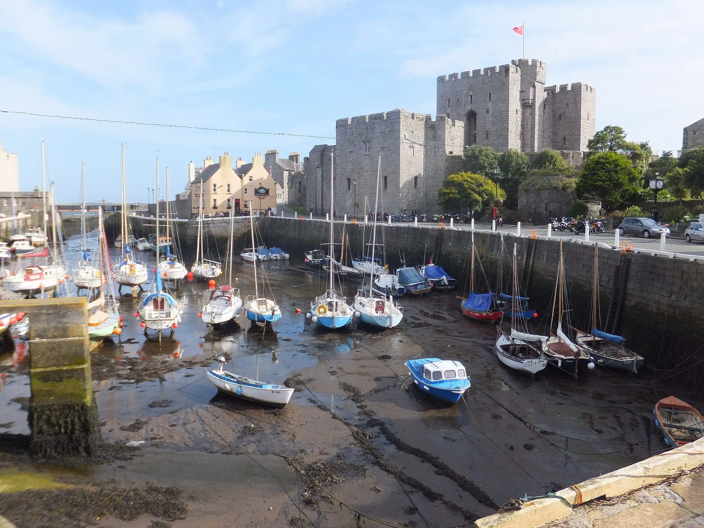
Photo: Richard Hoare / Wikimedia Commons, CC BY-SA 2.0
Isle of Man tide times — where to check them and why they matter
Photo: Richard Hoare / Wikimedia Commons, CC BY-SA 2.0
Last checked
Where to find official Isle of Man tide times for Douglas, Ramsey, Peel, Port Erin and Port St Mary, how the tide varies round the island, and when it matters.
On the map
- Douglas (standard port) — The island's reference port for tide tables
- Tower of Refuge — On Conister Rock. Only reachable at low springs — admire it from the prom
- Ramsey harbour — The biggest range on the island. The harbour dries at low tide
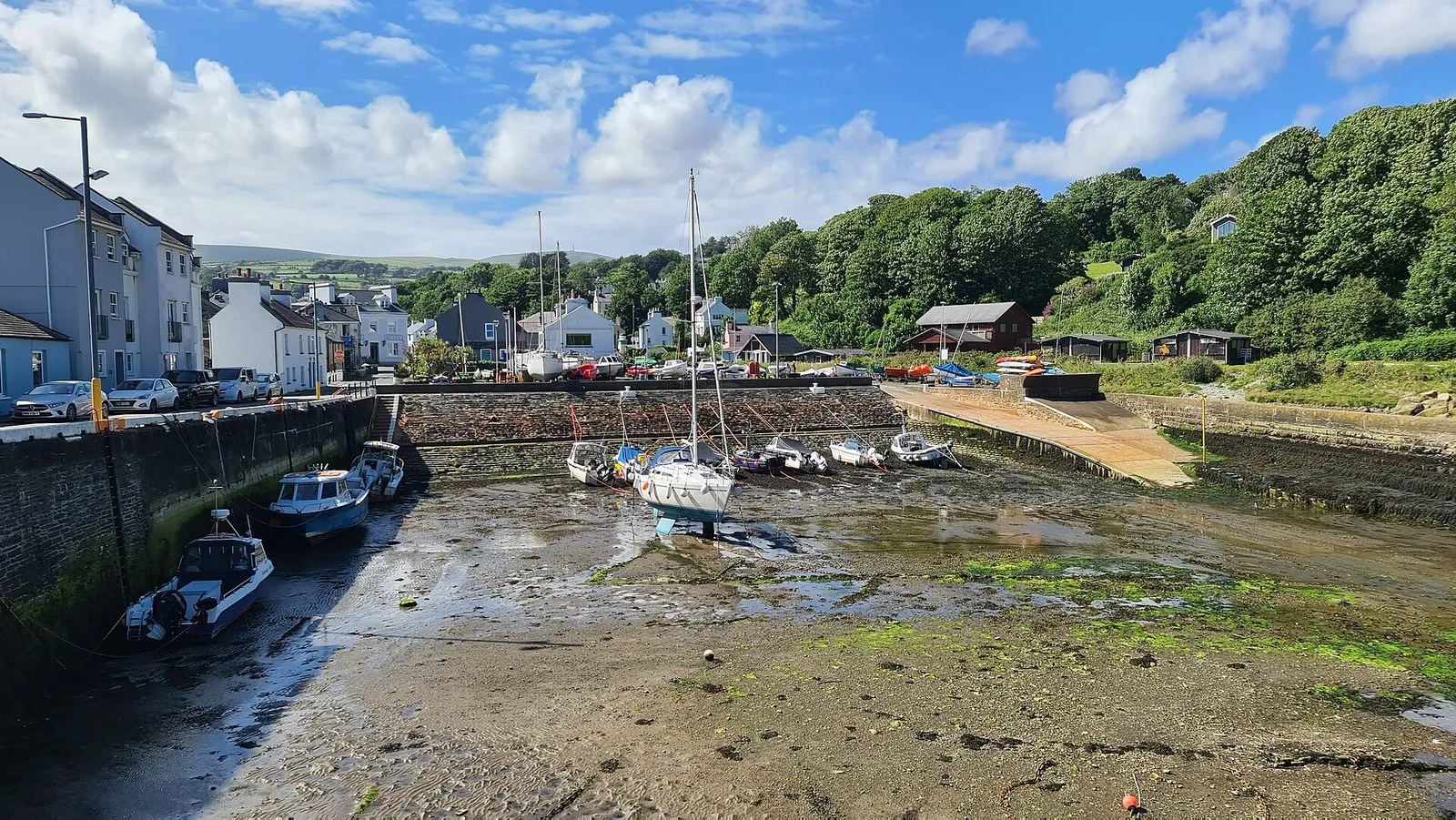
- Laxey harbour — Dries out at low water
- Peel — Smaller range than the east coast; inner harbour behind a tidal flapgate
- Niarbyl — Rock pools and the Niarbyl fault, best at low water
- Port Erin beach — Big sheltered sandy beach, much wider at low tide
- Calf Sound — A tide race. Boat trips to the Calf depend on it
- Port St Mary — Departure point for some Calf boat trips
- Castletown harbour — Dries out at low tide
- Langness — Rock pools on the Castletown Bay side, seals on the rocks
The sea round the Isle of Man goes up and down a long way: more than 6 metres at Douglas on a big spring tide. That decides whether there’s a beach, whether the rock pools are showing, whether a harbour has water in it, and whether a boat trip to the Calf runs. This page tells you where to get the official times and how to read them for the part of the island you’re in.
Where to get tide times
ADMIRALTY EasyTide (opens in a new tab) is the UK Hydrographic Office’s free tide service, and it’s the one to use. It gives seven days of high and low water times and heights, plus a tide curve, for six Manx ports:
- Douglas, the island’s standard port. Every other Manx prediction is worked out from Douglas.
- Ramsey, Peel, Port Erin, Port St Mary and Calf Sound, which are secondary ports.
Pick the port nearest to where you’ll be. Heights are in metres above chart datum, which is roughly the lowest the tide ever goes. Times are local time (BST in summer).
The Isle of Man Government’s weather page (opens in a new tab) links to the Douglas predictions. The harbours tides page (opens in a new tab) has tidal stream charts for sailors and the flapgate times for Douglas and Peel (more on those below). Its links for the other ports go to a commercial beach site.
For more than a week ahead, you’ll need a printed tide table or the Admiralty’s paid predictions.
How the tide differs round the island
The good news is that times hardly vary. The height is what changes. Here’s high water on one day, 28 September 2026, a spring tide, from EasyTide:
| Port | High water | Height |
|---|---|---|
| Ramsey | 11:59 | 7.5m |
| Douglas | 12:02 | 7.0m |
| Calf Sound | 11:59 | 6.2m |
| Port St Mary | 11:59 | 5.9m |
| Port Erin | 11:56 | 5.3m |
| Peel | 11:59 | 5.2m |
Low water that evening was between 0.3m and 0.9m everywhere. So the tide covers a lot more vertical distance on the east and north-east coasts than on the west. On the gently sloping sand at Ramsey or Douglas, that’s a lot of beach appearing and disappearing.
Springs and neaps
The range follows the moon. Around full and new moon you get spring tides (nothing to do with the season), with the highest highs and the lowest lows. About a week later come neap tides, when there’s much less difference between the two. At Douglas in the week we checked:
| Date (2026) | Low water | High water | Range |
|---|---|---|---|
| 28 September (springs) | 0.6m | 7.0m | about 6.4m |
| 4 October (neaps) | 2.3m | 5.4m | about 3.1m |
For rock pooling, you want a low tide at springs, around lunchtime. The biggest springs of the year come around the March and September equinoxes.
Why tides matter here
Beaches
Most Manx beaches look very different at high and low water. On a big spring tide the sea comes most of the way up the sand at the town beaches. At low tide the same beaches become enormous. If you want room for a game of cricket, or rock pools at the ends of the bay, go within a couple of hours of low water. If you want to swim without a long walk out, go nearer high water. Our beaches guide has the details for each beach.
Rock pools: Niarbyl and Langness
- Niarbyl, on the west coast, has some of the island’s best rock pools and the Niarbyl fault, a line of pale quartz across the shore that marks where two ancient continents met. Visit Isle of Man says the fault (opens in a new tab) is the only remnant of the Iapetus Ocean. It’s best seen at low tide. The little island off the point can only be reached over the rocks at low water, so keep an eye on the tide.
- Langness, the peninsula by the airport, has rock pools, sea arches and seals on the Castletown Bay side at low water. It’s an Area of Special Scientific Interest, so look but don’t collect.
Calf Sound and boat trips
Calf Sound, between the island and the Calf of Man, is a tide race. The stream runs hard through the gap either side of Kitterland, the rocky islet in the middle. Seals haul out on Kitterland, and you can watch them from the Sound café’s windows. The boats to the Calf work around the tide, and it decides both whether they sail and how long you get ashore. See our Calf of Man guide.
Harbours
Most Manx harbours dry out at low tide. In Castletown, Laxey, Ramsey’s old harbour and Port St Mary’s inner harbour, the boats sit on the mud, which explains the photos. The inner harbours at Douglas and Peel are kept afloat by flapgates, which only open around high water. The gov.im tides page (opens in a new tab) publishes the monthly opening times. That only matters if you’re on a boat.
The Tower of Refuge
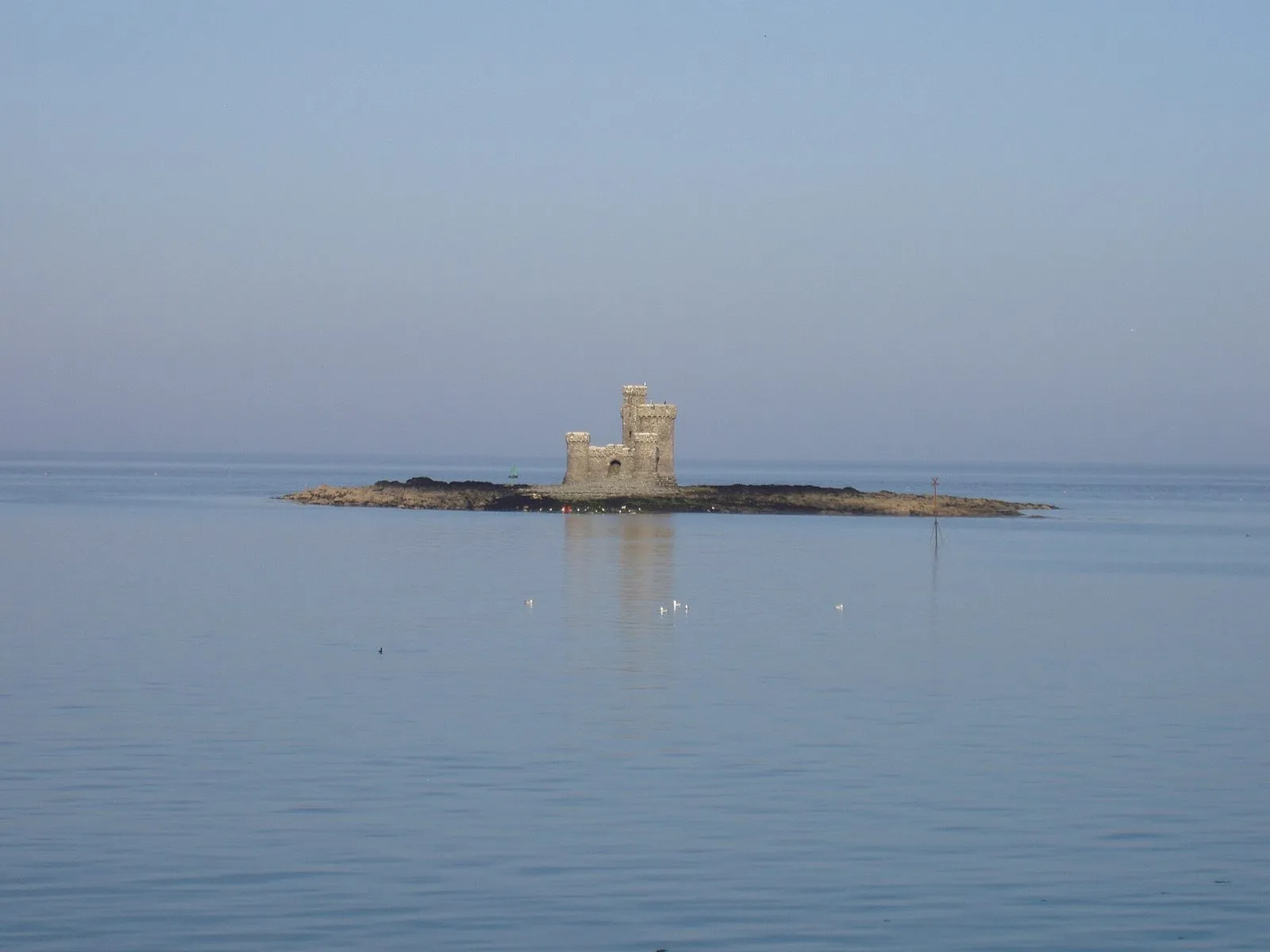
The little castle in Douglas Bay sits on Conister Rock, a reef where ships have come to grief. Sir William Hillary, the founder of the RNLI, had it built in 1832 as a shelter for shipwrecked sailors. On the lowest spring tides, you can technically reach it from the beach. Don’t: it’s slippery, weed-covered rock, and the tide comes back in around you.
Staying safe
- Check the tide before you set off, not when you get there. The Isle of Man Coastal Code (opens in a new tab) warns that parts of the coast can be cut off by the tide.
- Know which way it’s going. If you’re exploring on a falling tide, you’ve got time. On a rising tide, you haven’t.
- Watch your way back. Headlands, rocky points and small islets are where people get cut off. The route you walked out on may be underwater an hour later.
- Mind the rocks. Anything below the high-tide line is covered in weed and slippery.
- If you’re in trouble, or you see someone who is, dial 999 and ask for the Coastguard. Don’t try to wade or swim back against a rising tide.
The honest bit
— The Guru
Common questions
Where can I find official Isle of Man tide times?
The UK Hydrographic Office's free ADMIRALTY EasyTide service gives seven days of predictions for Douglas, Ramsey, Peel, Port Erin, Port St Mary and Calf Sound. The Isle of Man Government's weather page links to EasyTide's Douglas predictions. For further ahead, buy a printed tide table or the Admiralty tables.
Are tide times the same all round the Isle of Man?
Nearly. High water on 28 September 2026 was within about six minutes of noon at every port EasyTide lists. The height is what varies. High water reached about 7.5 metres above chart datum at Ramsey that day, 7 at Douglas, and just over 5 at Peel and Port Erin.
What is the tidal range at Douglas?
It depends on the moon. At spring tides the difference between low and high water at Douglas is over 6 metres. On 28 September 2026 it was about 6.4 metres. At neaps a week later it was about 3 metres. The biggest springs come around the equinoxes in March and September.
Can you walk to the Tower of Refuge at low tide?
Conister Rock can be reached from Douglas beach on the lowest spring tides, but the walk is over slippery, weed-covered rock and the tide comes back in around you. It isn't a sensible walk for visitors. The tower is best seen from the promenade.