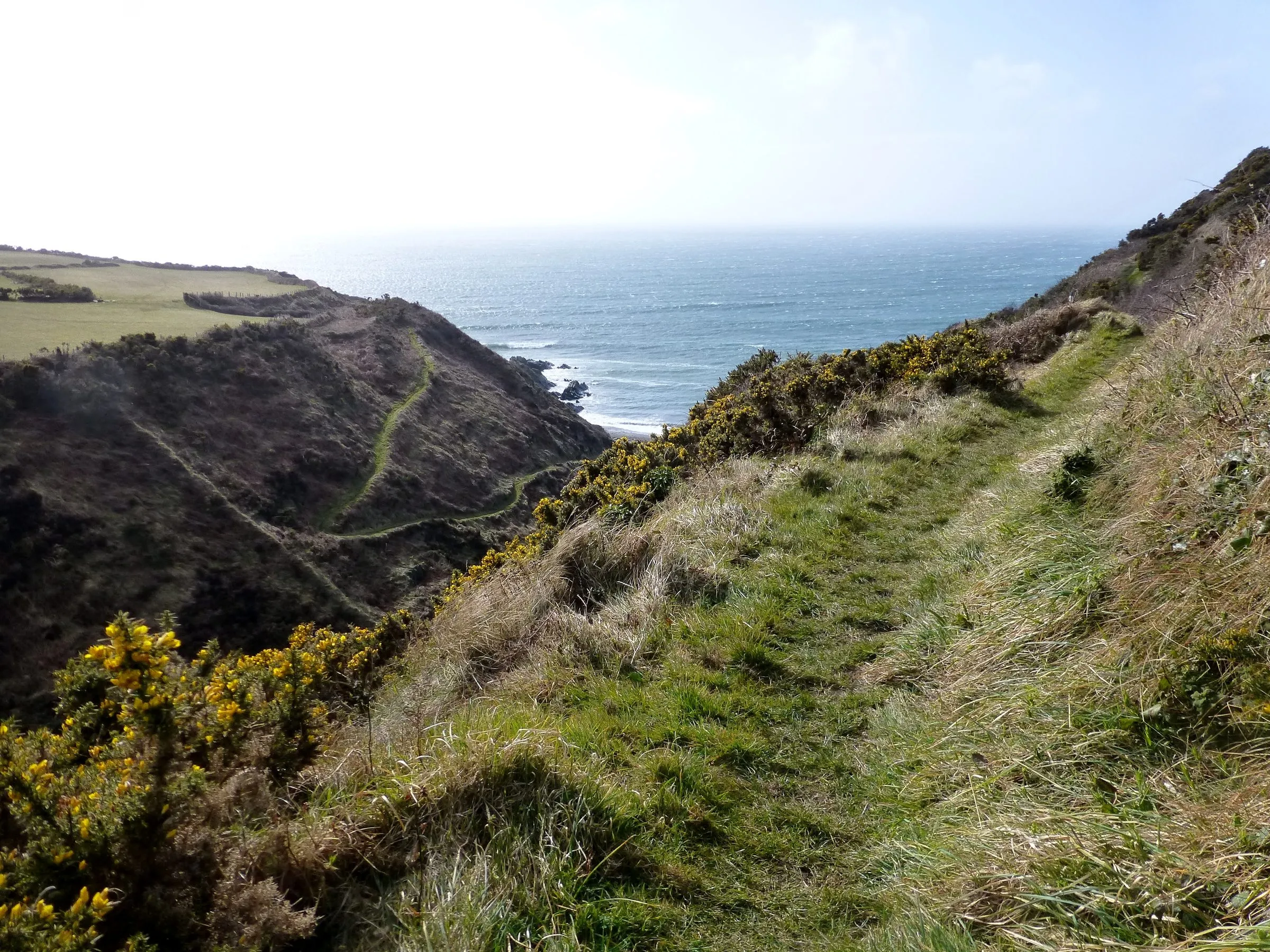
Photo: Rude Health / Wikimedia Commons, CC BY-SA 2.0
Raad ny Foillan — walking the Isle of Man coastal path, stage by stage
Photo: Rude Health / Wikimedia Commons, CC BY-SA 2.0
Last checked
How to walk the Raad ny Foillan, the Isle of Man's coastal path: every stage with distances, where to stay, getting back by bus or train, and current closures.
On the map
- Douglas (start and finish) — Traditional start at the harbour bridge
- Derbyhaven — End of stage 1, 12.5 miles
- Port St Mary — End of stage 2, 12 miles. Steam railway
- Port Erin — End of stage 3, 7 miles via the Chasms and the Sound
- Niarbyl — End of stage 4, 9.5 miles. The hardest stage
- Peel — End of stage 5, 6 miles via Glen Maye and Peel Hill
- Kirk Michael — End of stage 6, 7 miles
- Jurby — End of stage 7, 7 miles
- Point of Ayre — End of stage 8, 8.5 miles along the shingle
- Ramsey — End of stage 9, 5.5 miles
- Maughold — End of stage 10, 4.5 miles
- Laxey — End of stage 11, 8.5 miles. Back to Douglas is about 10
The Raad ny Foillan, Manx for “Way of the Gull”, is the coastal path round the whole Isle of Man. It’s about 100 miles of cliffs, coves, shingle and a few awkward road sections, and it opened in 1986 for the island’s Heritage Year. This page is for anyone planning to walk all of it or a few days of it. It covers the stages, where to stay, how to get back to your bed each night, and the current closures. For shorter walks, including the best single days on this path, see our Isle of Man walks guide.
How long is it, really?
It depends who you ask. The Isle of Man Government (opens in a new tab) says about 95 miles. Visit Isle of Man (opens in a new tab) says almost 100, and Wikipedia says 102. Add Visit Isle of Man’s stage lengths together and you get just under 100. Plan for 100 miles, because you’ll walk into a town for dinner, detour to a view, or follow a diversion at some point.
The stages
These are Visit Isle of Man’s 12 sections (opens in a new tab), walked clockwise from Douglas, with their distances and grades (checked September 2026). Visit Isle of Man doesn’t give a figure for the last stage. The 10 miles shown is the usual published figure for Laxey to Douglas.
| Stage | Miles | Grade | Getting back or on |
|---|---|---|---|
| 1. Douglas – Derbyhaven | 12.5 | Moderate | Buses on the Castletown road; the airport is near |
| 2. Derbyhaven – Port St Mary | 12 | Leisurely | Steam railway and buses |
| 3. Port St Mary – Port Erin | 7 | Moderate | Steam railway and buses |
| 4. Port Erin – Niarbyl | 9.5 | Strenuous | Nothing at Niarbyl itself. Arrange a lift |
| 5. Niarbyl – Peel | 6 | Moderate | Buses from Peel |
| 6. Peel – Kirk Michael | 7 | Moderate | Buses on the west coast road |
| 7. Kirk Michael – Jurby | 7 | Moderate | Limited buses. Check first |
| 8. Jurby – Point of Ayre | 8.5 | Leisurely | Very limited. Plan a pick-up |
| 9. Point of Ayre – Ramsey | 5.5 | Leisurely | Buses and the electric tram from Ramsey |
| 10. Ramsey – Maughold | 4.5 | Moderate | Limited. Or carry on to Laxey |
| 11. Maughold – Laxey | 8.5 | Moderate | Electric tram and buses |
| 12. Laxey – Douglas | About 10 | Moderate | Electric tram and buses |
The public transport column is our summary, not a timetable. Bus Vannin timetables change, and services in the north and west are thin, especially on Sundays. Check the exact buses for your day on Bus Vannin’s timetables (opens in a new tab) before you set off, not when you arrive.
The stretches, in brief
- Douglas to Castletown (stages 1–2). Out over Douglas Head along the old Marine Drive, past Port Soderick and Port Grenaugh, then round Langness. Some of stage 2 is on roads and the edge of the airport. It’s pleasant, but it isn’t why you came.
- Port St Mary to Peel (stages 3–5). The best three days on the path. First the Chasms and Spanish Head to the Sound, facing the Calf of Man. Then Bradda Head and the high, empty cliffs to Niarbyl, and finally Glen Maye and Peel Hill down into Peel. Stage 4 is the toughest on the route, with big climbs and nowhere to buy anything.
- Peel to the Point of Ayre (stages 6–8). Flat and wild. Part of it runs on the old railway line near Kirk Michael, then along low sandy cliffs and the shingle of the Ayres. Long stretches have no shelter and no shop.
- Point of Ayre to Douglas (stages 9–12). Along Ramsey’s beach, out to Maughold Head, then an up-and-down east coast via Port Cornaa, Dhoon and Laxey, back to Douglas along Onchan’s cliffs.
Planning
When to go
From May to September you’ll get the longest days and the steam railway and electric tram to take you home. The railways’ 2026 season ends on 1 November. Spring brings gorse, bluebells on the east coast and nesting seabirds. Late summer turns the heather on the south-west cliffs purple. Avoid TT fortnight (31 May to 12 June in 2027) unless you’ve already booked, because every bed on the island goes and the roads you’ll cross are closed for racing. See best time to visit.
Maps and navigation
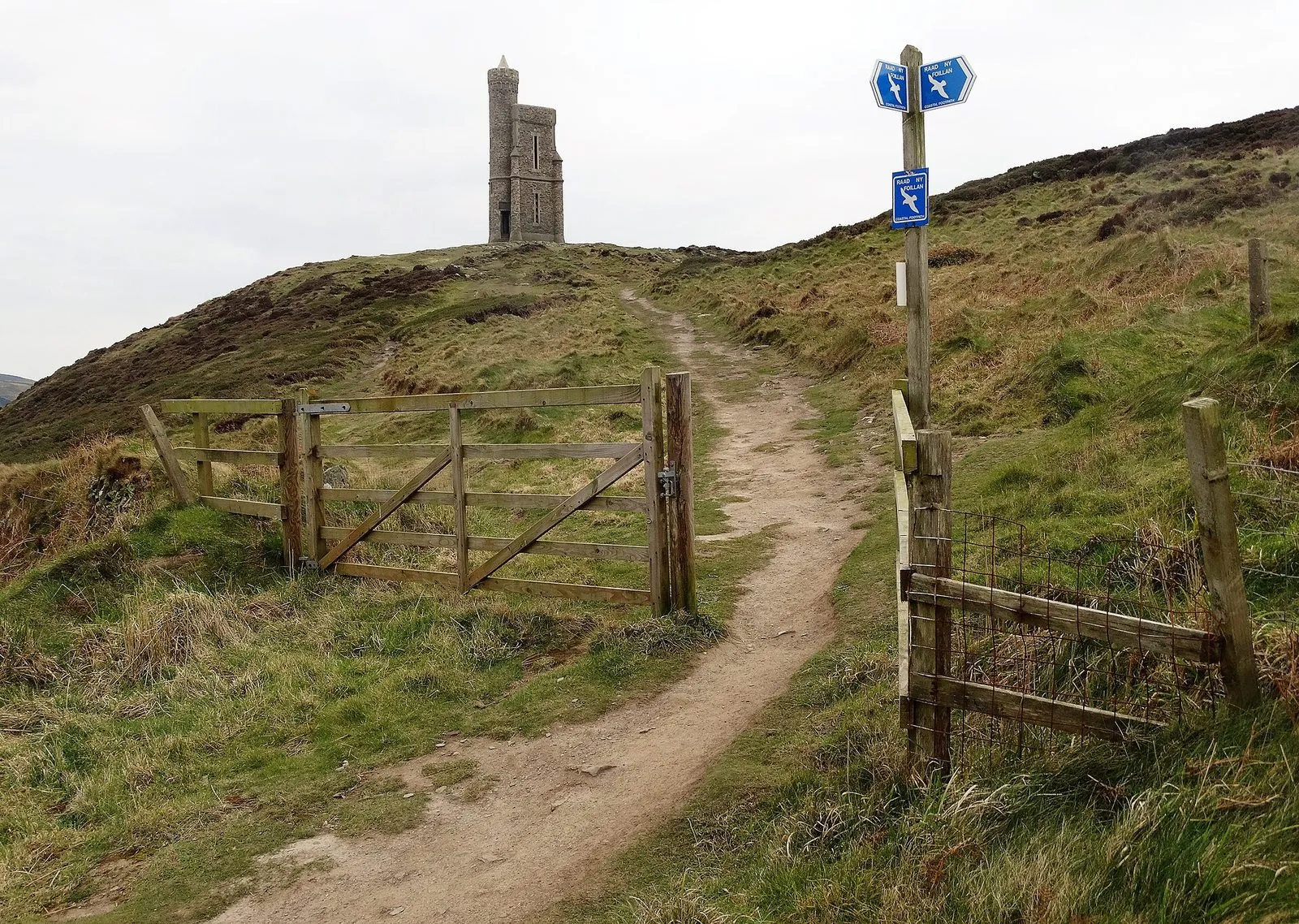
The waymarks are blue signs with a white gull. They’re good around towns and thinner on open cliff. The Isle of Man Government publishes stage maps and a downloadable 1:25,000 map on its coastal walk page (opens in a new tab). It says plainly that the path is for experienced walkers and that its own sketch maps aren’t for navigation. Carry the full map or a GPS track. Cicerone publishes a guidebook to the path (opens in a new tab) if you want route notes in your pocket.
Where to stay
There are two ways to do it:
- Stay in two or three bases and use transport. Douglas, Port Erin or Port St Mary, Peel and Ramsey cover most stages. Each morning you catch a bus, train or tram to where you left off. It’s the easiest option, and your bag stays in the room.
- Move every night. You get more of the feel of a proper long-distance walk. But beds are sparse in the north-west (Kirk Michael to the Point of Ayre) and around Niarbyl, so book those nights first.
Visit Isle of Man keeps a list of places to stay along the route (opens in a new tab). Our where to stay guide says which town suits whom.
Bags
We couldn’t find a scheduled baggage-transfer service for the path in 2026. That’s the main reason the base-and-transport approach works best here. If you’re moving every night, a taxi between towns is the fallback. Ask your accommodation whether they’ll arrange one.
Closures and diversions
Coastal paths fall into the sea. As of September 2026:
- Port Erin. Two short sections in Port Erin were shut by landslips in late 2023 and early 2024. In October 2024 Port Erin Commissioners said the repair quotes were “cost prohibitive” and the sections would stay closed for the foreseeable future (Manx Radio (opens in a new tab)). We couldn’t find confirmation that they’ve reopened since. Follow the signed diversion on the ground.
- Orrisdale, north of Kirk Michael. The path follows the old railway line here. The Department of Infrastructure closed it from 9 February 2026 to replace two bridge decks, with a diversion in place. The closure was later extended to 22 May (3FM (opens in a new tab)). We couldn’t find a reopening notice, so check the Department of Infrastructure’s updates (opens in a new tab) before you walk stage 7.
- The Sound to the Chasms. This stretch was taped off on 27 August 2026 after ordnance was found, then reopened the same morning once it was made safe (Manx Radio (opens in a new tab)).
If you find a blocked path, fallen sign or new landslip, report it at reportaproblem.im (opens in a new tab).
Doing it fast
The path is also a running challenge. The fastest known time is 21 hours, 21 minutes and 25 seconds, set by Orran Smith in October 2020. That’s a useful number to have in mind on day seven, when your blisters want to know why you’re taking a fortnight.
— The Guru
Common questions
How long is the Raad ny Foillan?
About 100 miles. The Isle of Man Government says around 95, Visit Isle of Man says almost 100, and other sources say 102. The difference comes down to detours and which diversions you count. Plan on 100.
How many days does it take to walk the Raad ny Foillan?
Most people take 8 to 12 days. Visit Isle of Man splits it into 12 stages of 4.5 to 12.5 miles. Strong walkers do it in five or six long days, and the record for running it is just over 21 hours.
Which way should I walk the Raad ny Foillan?
Clockwise from Douglas, heading south first, is the usual direction and the one Visit Isle of Man's stages follow. It puts the best scenery, in the south-west, early in the trip, while your legs are fresh.
Is the Raad ny Foillan waymarked?
Yes, with blue signs showing a white gull. They're good near towns and patchier on open ground, so carry a map or a GPS track, especially on the cliffs between Port Erin and Niarbyl.